|
HOURS: 2-3
|
DISTANCE: 5.2 miles (8.40km)
|
STYLE: RIVER
(non-navigable) |
MONTH ATTEMPTED: AUGUST
|
SUP RATING: *****
|
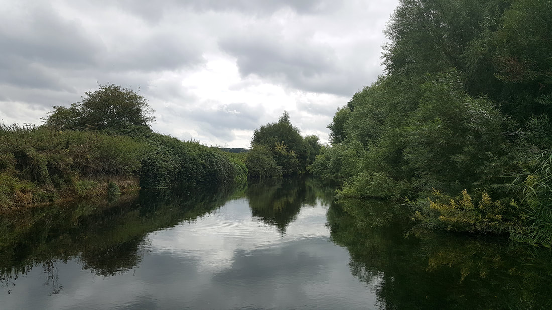
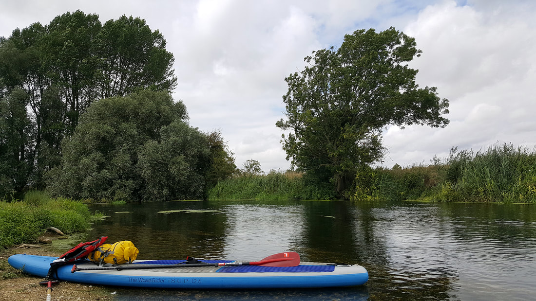
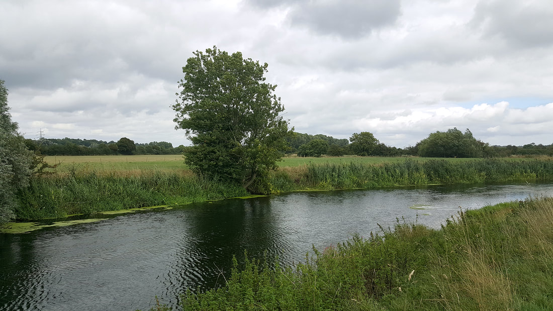
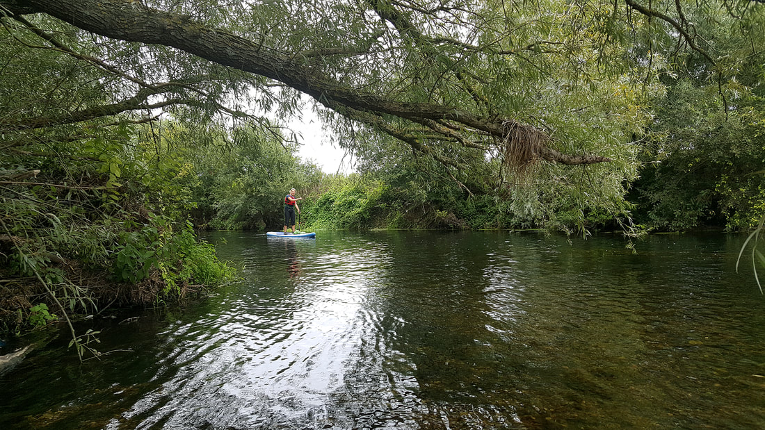
BETWEEN THE WEIRSThe River Stour runs from a large catchment area in Wiltshire before flowing into Dorset and heading due south to meet the English Channel. A particular area of interest is a 2.6 mile (4.20km) stretch that passes near the village of Cowgrove that can be accessed via a *National Trust Car Park at Eye Bridge Weir.
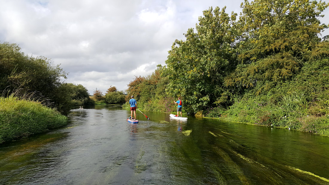
The entry is very shallow over rocky terrain (footwear is advised). From here you paddle up stream (against the flow) around gentle bends for approximately 2-miles (3.22km) passing fields and wildlife - including swans and kingfishers - until you meet another weir that is particularly picturesque and active after rainfall. Although it may feel like you cannot go any further the route actually stretches for another 0.5 miles (0.8km). Just proceed through the light foliage on the right hand side of the weir to access the final stretch towards the end (marked by another weir). It is worth the effort and you will be rewarded with even more secluded wilderness. The water is so clear that you can see fish and eels passing below your feet. The depth changes regularly from fin scraping to deep enough to tread water. A word of warning, after a heavy downpour the flow can be quite severe and the journey can turn into a full-on workout. Also, at this time of the year (August) and after hot weather the bed weeds rise closer to the surface line catching your fin, which can slow your speed and cause drag. There are no amenities lining the route so you will need to carry food, drink and any snacks you require for the paddle. |
TYPE OF TRAIL: Out and Back
(2.6 miles / 4.20 kilometres each way) PORTAGES & LOCKS: 0 (NIL) 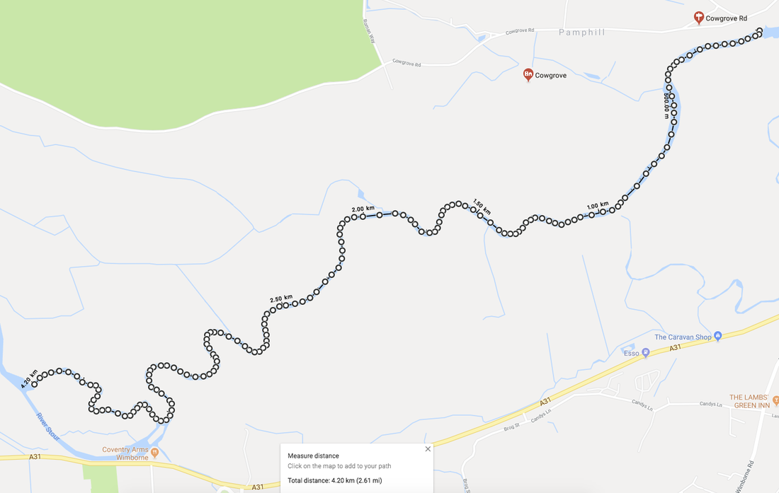
IMPORTANT INFORMATION* WARNING
The National Trust Car Park at Eye Bridge is a known hotspot for thefts from cars. It is advisable to keep all belongings that you aren't taking onto the water out of sight or locked in the boot. |